
Bhote Koshi Flood 2026: What Happened and Nepal Travel Update
 Sristi Adhikari
On August 26, 2026, northern Nepal faced a serious natural disaster of Bhote Koshi Flood. The sudden Nepal flash flood struck the Bhote Koshi River corridor on Bhadra 10, 2083 causing extensive damage in Rasuwa and downstream areas.
For travelers, however, it is important to understand the difference between the Bhote Koshi Flood disaster zone and Nepal as a whole. The Nepal flood of 2026 has affected homes, roads, bridges, hydropower facilities, and other infrastructure of the northern routes along the Bhote Koshi river corridor severely.
Whereas many other tourism destinations like Kathmandu, Pokhara, Everest and Annapurna remain outside the directly affected area and are safe to travel in 2026. If you have booked a trekking adventure near the affected area, we suggest you postpone or book another trekking adventure in Nepal.
Continue reading this travel update for details on what is the cause and where the Bhote Koshi Flood occurred and which region should you visit instead of Northern Nepal in 2026.
What Happened in the Nepal Bhote Koshi Flood 2026?
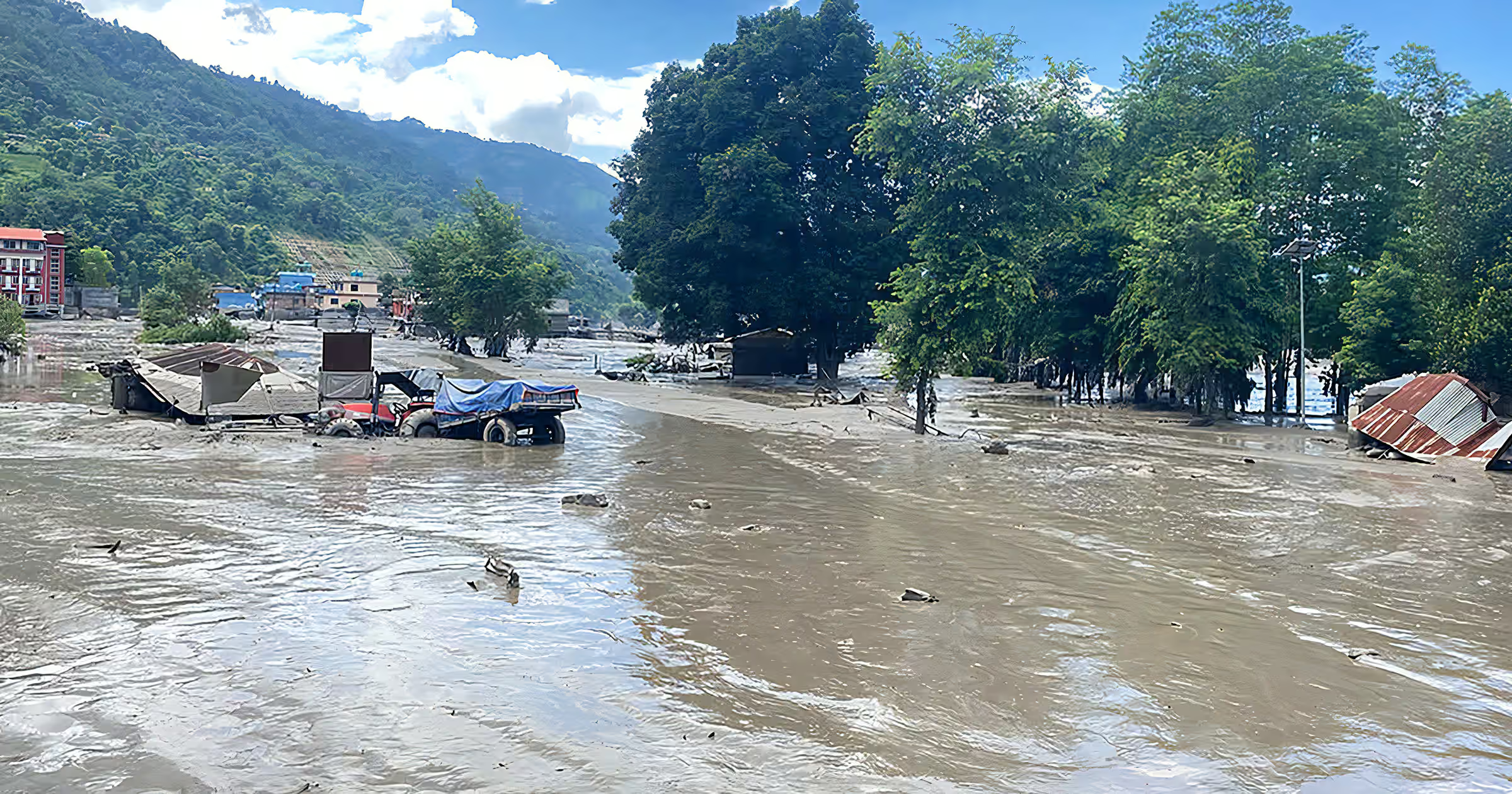
The Bhote Koshi river received a flash surge of water from Lhende Khola which connects it at the Rasuwagadhi border resulting in a destructive Nepal flood on August 26, 2026. It severely affected the Bhote Koshi River corridor in northern Nepal and mostly the Rasuwa district.
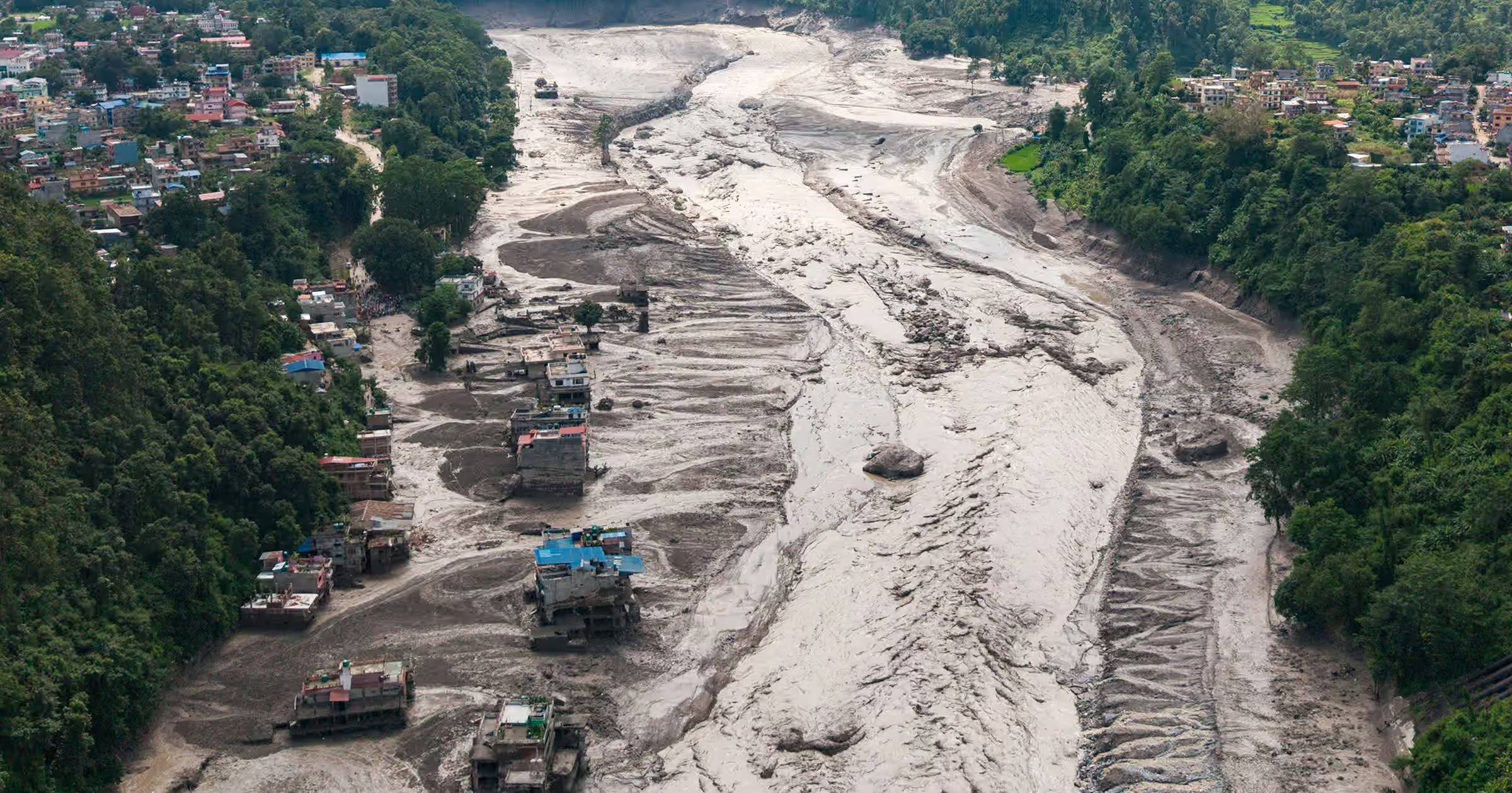
It was around 9 in the morning when a Lhende Khola received a flash flood and within a minute of time it came down to Bhote Koshi river sweeping away the Nepal-China border around the Rasuwagadhi-Gyirong crossing point.
This devastating flash flood has swept away many debris downstream with human settlements, roads, bridges, hydropower infrastructure, etc. The Bhote Koshi Nepal flood 2026 has also affected areas such as:
- Trishuli River in Rasuwa,
- Nuwakot,
- Dhading,
- Nawalpur
- and Gorkha Districts,
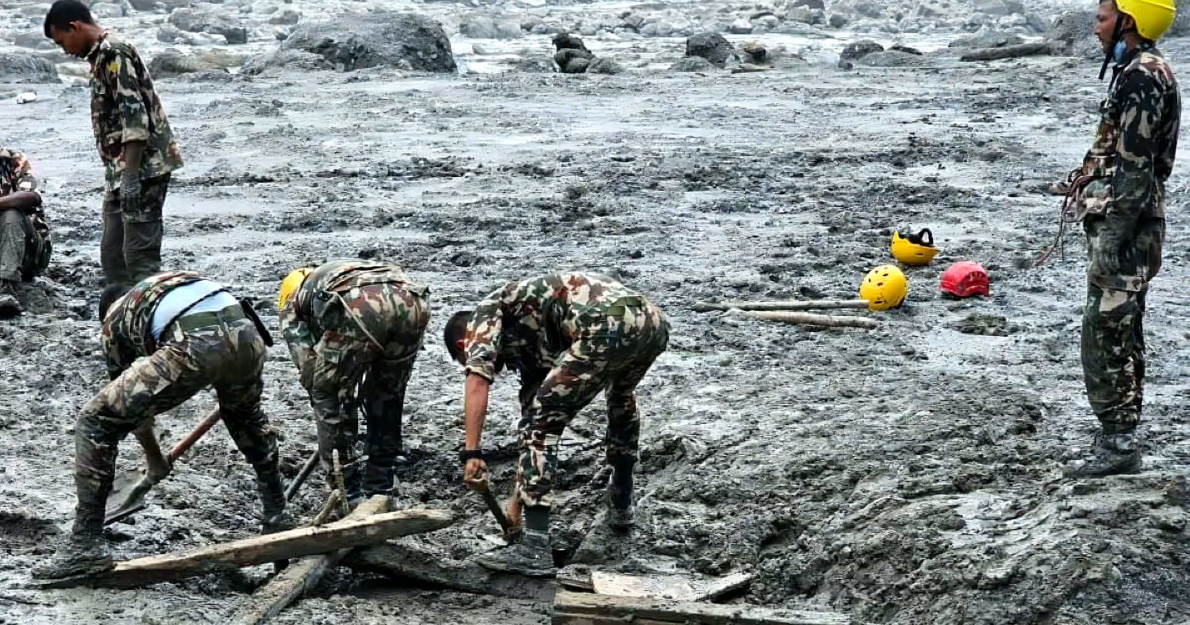
As of now, Nepal Government has been continuously working for searching and rescuing the flood victims. Around 19000 security personnel and 16 helicopters have been mobilized for the search, relief, recovery and rescue operation. According to press briefing by the Spokesperson on Bhote Koshi Flood:
- Total rescue: 10,000 people
- Still unaccounted : 4247 people
- Foreign nationals: 323 rescued
- Foreign nationals: 592 from 39 countries still missing.
- Death Toll: 903
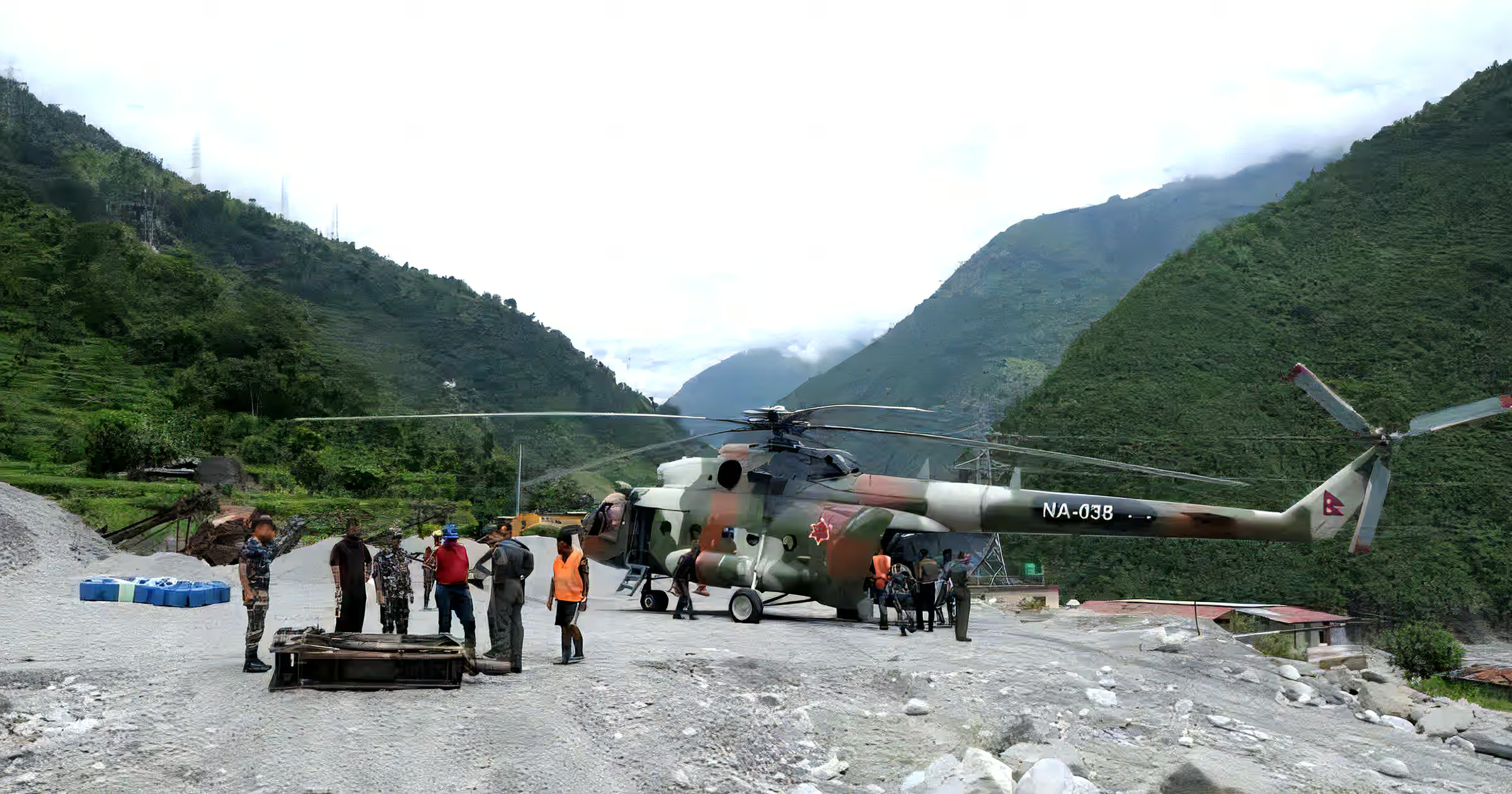
Some authorities also believe that many workers might have been trapped inside the tunnel of the hydropower and are continuously searching for the missing ones.
Where Did the Nepal Bhote Koshi Flood Happen?
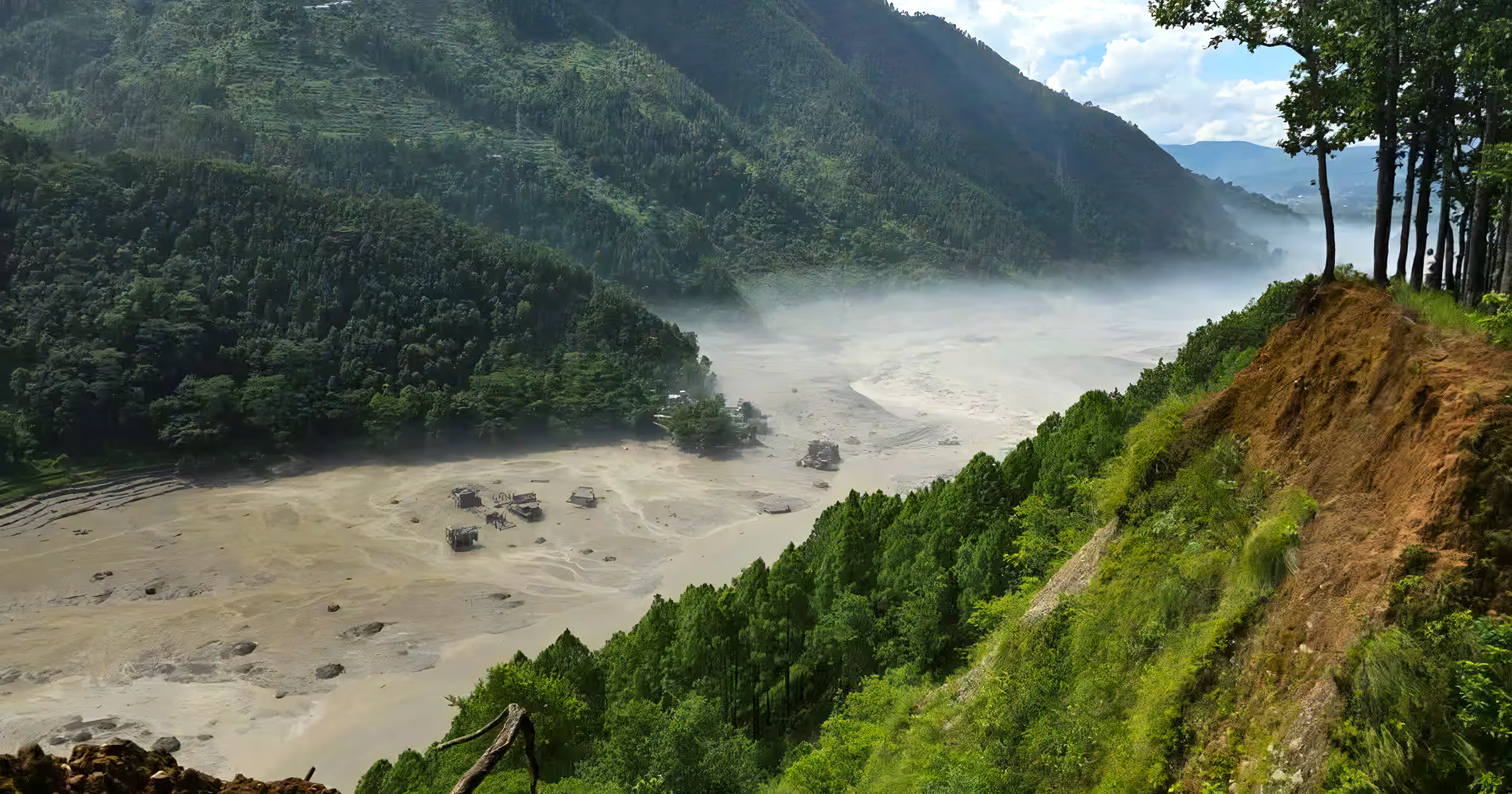
The primary location of Nepal Flood is in the Bhote Koshi river corridor of Rasuwa District near Nepal’s northern border with China. The massive surge of flood water from above part of Tibet affected the areas such as:
- Rasuwa
- Syabrubesi
- Langtang
- Rasuwagadhi
- Timure
- The Nepal-China border area
According to some captured CCTV footage, the flood wave moved at a speed of around 120 mph and crossed 22km within the blink of an eye. These floodwaters and huge surge of debris moved downstream in such a way that it became a regional emergency rather than an isolated incident.
For travelers who had planned northern trekking and pilgrimage routes, the main gateway to them, Rasuwa, which was completely affected by Nepal flash flood 2026, we suggest you choose alternative regional routes.
What Caused the Nepal Flash Flood 2026?
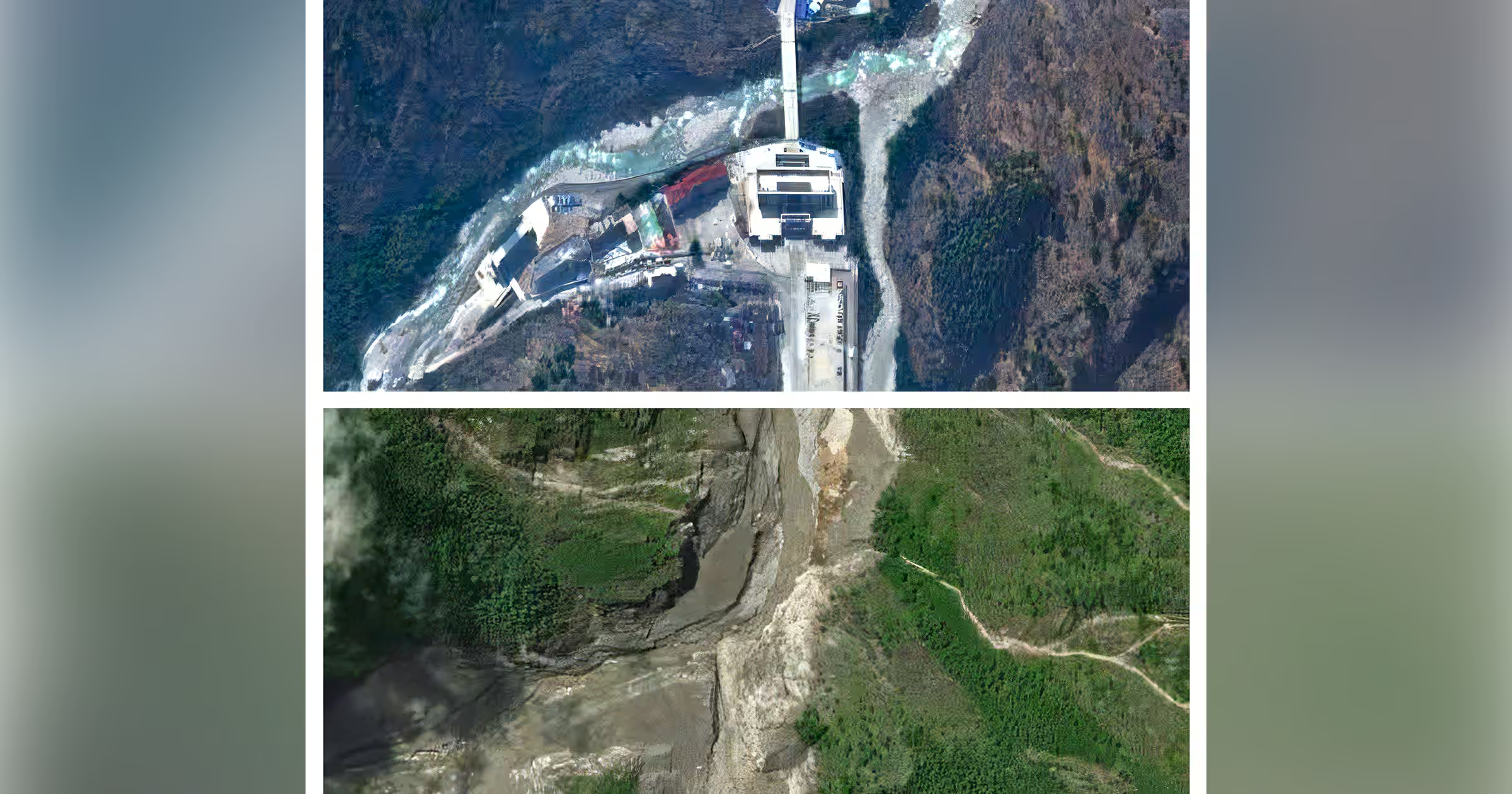
According to the Preliminary scientific assessments from disaster authorities of Nepal and from glaciologists reviewing satellite imagery, it is believed that a large mass of glacial ice got separated off near Langtang Lirung. Then, it fell directly in the Lhende valley which is only 20km northeast from Nepal-China border.
The debris blocked the river system and after some period of time, it could not hold and released everything at once resulting in flash Bhotekoshi flood followed by flood in Trishuli river system. It was also reported during that time earth received seismic shaking which later confirmed was due to a landslide rather than an earthquake.
10-Hours Timeline of Bhote Koshi Flood 2026
When a major surge of flood hit the Bhotekoshi river in Rasuwa on Wednesday morning from Tibet side, it travelled downstream to Trishuli and Narayani river. Here is the detail timeline how Bhotekoshi flood took a devastating way within 10 hours:
8:37 AM — Earthquake Recorded
A magnitude 4.4 earthquake was detected before the flood emergency unfolded.
8:40 AM — Last River Reading
The Syabrubesi monitoring station recorded the Bhote Koshi River at approximately 1.62 metres in its final transmitted reading.
8:50 AM — Monitoring Station Loses Connection
The Syabrubesi river station stopped transmitting data, disrupting real-time monitoring in the upper Bhote Koshi corridor.
9:05 AM — Major Flood Reported
Authorities received information that a powerful surge had entered the Bhote Koshi River from the Tibetan side.
9:15–9:16 AM —Emergency Alerts Issued
Authorities sent SMS warnings to communities along river corridors in Rasuwa, Nuwakot, Dhading and Chitwan. More than 600,000 messages were reportedly distributed.
9:20 AM — Betrawati Station Stops Transmitting
Another river-monitoring station, at Betrawati, lost its data connection. Its last recorded river level was around 3.55 metres.
10:28 AM — Flood Expected Farther Downstream
Authorities projected that the flood would move toward Dhading-Galchhi and Muglin, prompting additional warnings for communities and people traveling along major highways and the Trishuli River corridor.
11:26 AM — Danger Level Exceeded
The river at the Phurke/Malekhu monitoring station rose beyond its designated danger threshold.
11:43 AM — Bridge and Structures Swept Away
The rapidly rising water destroyed the Phurke river bridge and other nearby structures.
11:50 AM — Flood Reaches Malekhu
Floodwaters moved into the Malekhu area, continuing their downstream progression through the river system.
1:00 PM — Flood Passes Muglin
Authorities confirmed that the main surge had already moved beyond Muglin and warned communities farther downstream toward Devghat to move to safer locations.
1:30 PM — Devghat River Rises
The water level at Devghat reached approximately 4.76 metres, with further increases still expected.
2:14 PM — Kalikhola Reaches Danger Level
The Kalikhola monitoring station recorded water levels above the danger threshold. Its eventual peak reached approximately 12.3 metres.
3:20 PM — Flood Reaches Narayani–Devghat
The flood reached the Narayani-Devghat area, while the river was still rising.
4:00 PM — Devghat Reaches Peak Level
The river at Devghat reached its highest reported level of approximately 6.57 metres before beginning to decline.
6:30 PM — Water Level Begins to Recede Significantly
By the evening, the Devghat river level had dropped to around 4 metres, marking the end of the main flood surge’s rapid downstream progression.
Within a 10 hour period, flood from Bhotekoshi river reached downstream to Devghat and took the life of hundreds of people collapsing their home, connecting bridges, and other infrastructures.
What Damage Did the Bhote Koshi Flood Cause in Nepal?
According to the National Disaster Risk Reduction and Management Authority (NDRRMA), the death toll of Bhotekoshi flood reached 903 where 4247 people are still unaccounted for. With human fatalities, it swept away infrastructure and even disrupted transportation in the affected areas.
The major impact includes:
- Damaged or destroyed houses in Timure and Syabrubesi along with Nuwakot and Dhading.
- Washed-out roads and highways
- Damaged bridges
- Disrupted hydropower infrastructure
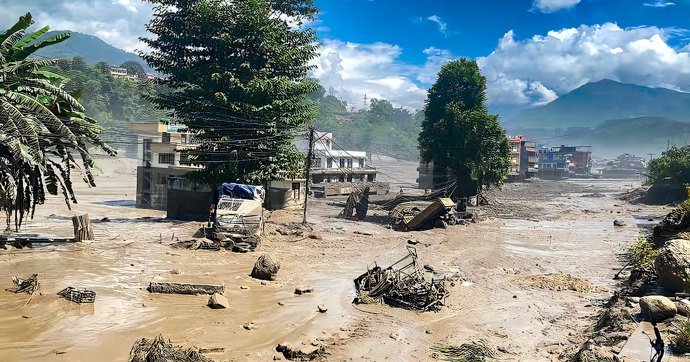
- Flooded settlements
- Transportation interruptions
- Damage around the Nepal-China border corridor
- Difficult access for emergency and rescue teams
Road damage is especially important for tourism because many trekking destinations in northern Nepal depend on road transportation before the walking portion of a journey begins. The Bhote Koshi Flood 2026 therefore affects tourism not simply because of flooding itself, but because roads, bridges, accommodation facilities and local communities require time to recover.
Is Nepal Safe to Visit After the Bhote Koshi Flood in 2026?
One of the biggest questions following the Bhote Koshi Flood is whether travelers should cancel their Nepal trips. The answer heavily depends on the destination you are planning to visit.
Nepal is a geographically diverse country. The Bhote Koshi flash flood affected the river and Trishuli corridors, but this does not mean that every tourism destination in Nepal has been affected.
The regions and areas that has been closed for tourism activities are:
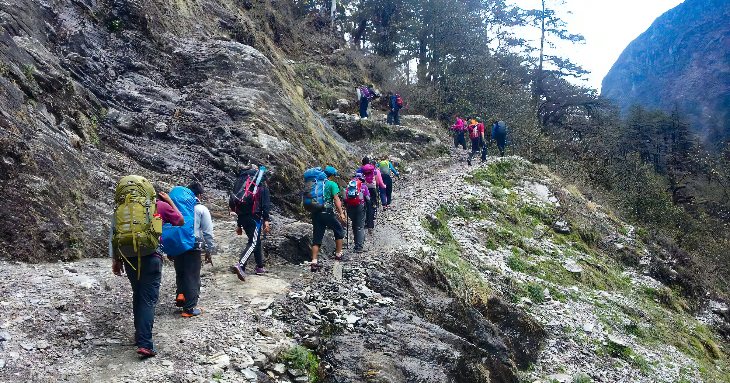
- Langtang ( Langtang Valley Trek, Tamang Heritage Trek, Gosaikunda Trek, Helambu trek, etc)
- Pasang Lhamu Highway
- Rasuwa and Bhote Koshi corridor
- Galchhi–Syabrubesi road
Whereas areas and destination which has been operating normally are:
- Kathmandu Valley,
- Tribhuvan International Airport,
- Pokhara,
- Annapurna,
- Everest/Khumbu,
- Chitwan and Bardiya,
- Lumbini and the Terai.
Travel Advice for Visitors to Nepal After the Bhote Koshi Flood 2026
If you are planning a Nepal trip following the Bhote Koshi Flood, consider the following precautions.
Check Your Exact Route
Do not ask only, “Is Nepal safe?” Instead, ask: Is my specific destination, road, trekking trail and transportation route currently safe and operating or not. Conditions can vary significantly between regions.
Make Sure You Avoid Rasuwa, Northern Nepal
Travelers should not enter restricted areas near Bhotekoshi river corridors and avoid routes like Rasuwa, Syabrubesi until the situation becomes normal. Search operation via both ground and aerial is going on, so don’t disturb official by asking unnecessary question.
Keep Your Itinerary Flexible
You should have extra days on your trekking or travel itinerary as landslides may cause road blockage and delays when traveling in monsoon season.
Make Distance from Flooded Rivers
After a Nepal flood 2026, rivers may change their volume, so avoid going near rivers or bridges for photo and videography.
Use Local Travel Operators
A reliable local trekking agency like Awesome Holidays Nepal can provide more practical information about current roads, trail conditions, accommodation and alternative routes. This is particularly important when traveling shortly after the Rasuwa flood 2026.
Planning to Travel Nepal in 2026?
Or Call/Message on WhatsApp +977 98434 13619
Check Travel Insurance
We also recommend you to buy an appropriate travel insurance covering the planned itinerary, activities and emergency expenses in 2026.
Final Thoughts on Bhote Koshi Flood 2026
The devastating Bhote Koshi Flood in Nepal has offered the glimpse of how unpredictable and powerful mother nature can be. Within a minute of time, the destructive Nepal Flash flood took the lives of several families while sweeping roads, bridges, homes, and infrastructure into the muddy and debris-filled flood water.
The Bhote Koshi Flood has severely disrupted northern corridors of Rasuwagadhi-Timure-Syabrubesi trade route but this does not mean every part of Nepal is unsafe to travel in 2026. You are only restricted to trekking in the Langtang region and other trekking trails to Everest, Annapurna, Manaslu, and other Eastern Nepal are currently open and safe.
When traveling to Nepal’s different regions, we suggest you to be updated regarding terrain with verified sources, avoid restricted areas, confirm transportation conditions and remain flexible. If you want to help flood victims, you can directly donate through the official online portal at Prime Minister’s Disaster Relief Fund Portal which accepts international cards.
As Nepal is in the phase of recovery from the devastating Bhote Koshi Flood, your responsible travel can help support local communities and contribute to the country’s recovery. So, plan your Nepal trip today with Awesome Holidays Nepal for 2026/27.
FAQs
Expand AllWhat happened in Bhote Koshi flood 2026?
On August 26, 2026, a massive surge of water, ice, rocks and debris downstream with the outburst of glacial ice near Langtang Lirung causes a massive flood in Bhotekoshi river which took life of hundred and more than thousands are still missing.
When did Bhote Koshi flood happen?
On August 26, 2026, at around 8:40–9:00 AM, Bhote Koshi flood happened.
Where is Bhote Koshi flood in Nepal?
The primary location of Nepal Flood is in the Bhote Koshi river corridor of Rasuwa District near Nepal’s northern border with China.
What caused Bhote Koshi flood Nepal?
When a large mass of glacial ice got separated off near Langtang Lirung, it fell directly in the Lhende valley which causes a devastating flow of flood water into Bhote Koshi river.
Was Bhote Koshi flood caused by glacier collapse?
Yes, it is believed that Bhote Koshi flood was caused by glacier collapse near Langtang Lirung.
Is Nepal safe to travel after flood 2026?
Yes, Nepal is safe to travel after flood 2026.
Which areas of Nepal are affected by flood 2026?
Bhote Koshi, Trishuli corridors, along with district like Rasuwa, Nuwakot, Dhading and parts of Chitwan, are affected by Nepal flood 2026.
Is Kathmandu safe after Nepal flood 2026?
Yes, Kathmandu is safe after Nepal flood 2026.
Is Pokhara safe after Nepal flood 2026?
Yes. As Pokhara was not directly affected by the Bhote Koshi flood, it is safe.
Is Chitwan safe after Nepal flood?
Chitwan is under a high-alert warning, so we suggest you not to travel until water levels in the Narayani and Rapti rivers slows down.
Is Everest Base Camp trek affected by Nepal flood?
No. Everest Base Camp trek is not affected by Nepal floods 2026.
Is Annapurna Base Camp trek affected by Nepal flood?
No. Annapurna Base Camp trail was not directly affected by the Bhote Koshi flood.
Is Annapurna Circuit affected by Nepal flood
No. The main trailhead of Annapurna Circuit is Besishahar which you need to reach via Prithvi highway which is destructed due to landslide in Krishnabhir.
Is Manaslu Circuit affected by Nepal flood?
No, the Manaslu Circuit is not affected by Nepal flood 2026 as it is outside the Bhote Koshi flood corridor.
Is Langtang trek open after Rasuwa flood?
Langtang trek after Rasuwa flood is closed as Syabrubesi is highly affected.
Is Gosaikunda trek open after flood?
Gosaikunda trek after Bhote Koshi Nepal flood 2026 is closed via Dhunche while aletrantive foottrails via Dupcheshwor, Sisipu, Talu, Phedi, and Suryakunda Pass is still open.
Is Tamang Heritage Trail open after flood?
No. The Tamang Heritage Trail is currently closed and is unavailable for trekking following the severe flash floods on August 26, 2026.
Is Syabrubesi road open after flood?
No. Syabrubesi road is not open after flood.
Is Rasuwagadhi border open after flood?
No. Rasuwagadhi border is not open after flood.
Is Kailash Mansarovar overland route open after flood?
The primary overland route to Kailash Mansarovar via Rasuwagadhi and Kerung is closed after Rasuwa flood 2026.
Related blog posts
Discover a choice of tourist destinations loved by most of our visitors. Whether you're on a jungle safari to spot rare animals or walking through a world heritage site, these well-planned itineraries cover the major highlights of Nepal.



 call an expert at: