The Forgotten Mount Kailash Expedition 1905

 Amrit K. Aryal
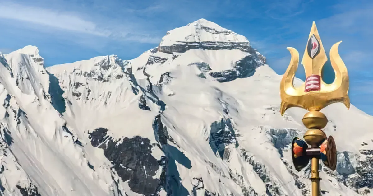
Mount Kailash draws the attention of both the spiritual and the political. The sacred peak stands, the holy mountain sits silent in the far west of the Ngari Prefecture region of Tibet. Mount Kailash is one of the most holy mountains for Hindus, known as the abode of Lord Shiva.
Shiva is one of the faces in the Trideva in the Bharat Khanda. We are at the end of 2025, and still, the mystery of Kailash Parvat encircles old maps and unspoken border stories. Long before the Mount Kailash expedition of 1905, the modern territories were established; Mount Kailash was not a land to be owned, but instead considered a cosmic symbol by the world.
Pilgrims from India, Nepal, and Tibet needed no passports or visas. They required no permission to visit the spiritual lands of Kailash and Mansarovar.
So many things changed after 1905. The colonial surveys of the 1905 Tibet expedition, the Sino-Kashmiri geographic survey, and what historians call it the Forgotten Himalayan expeditions.
These surveys, with a mission to map the mountains, also changed the fate of the cartography of Mount Kailash. These mapping missions, especially the Mount Kailash expedition 1905, put the Tibet and surrounding areas within the boundaries of the Tibet Autonomous Region under the Chinese government.
Is it really about political administration or any other? Many historians believe it was the mappers, explorers, who made the decisions in cold tents under a clouded Himalayan sky, without the actual survey.
Kailash Before Borders
Before nations drew borders, there was Kailash, a center of the universe, an Axis Mundi. For Hindus, it was Lord Shiva’s home. For Buddhists, it is the abode of Demchok. To Jains, it was where Rishabhdev got enlightened. And to Bon followers, it is the central universal axis. Before the world was divided into borders, mountains had no rulers.
The kingdoms of Tibet, Ladakh, and Kashmir had pilgrims, not soldiers. The pilgrims and travelers had faith and a message of global peace. The Kailash Mansarovar had monks, merchants, and worshippers. But the story changed as the countries drew borders.
Pre-modern Kailash Maps
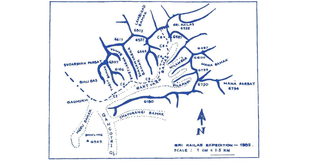
When travelers and explorers began mapping Mount Kailash, they were not certain of its exact location. Without certain coordinates, the Indians marked Mount Kailash in Kashmir, and the Chinese marked it under Western Tibet. As there were no exact marks, but with the help of some glaciers, rivers, and hills, various maps were found with different markings of Kailash.
These uncertain maps existed till the 19th century. Then came the British expedition team into existence. They had their eyes on the Tibetan plateau, with advanced scientific tools and instruments.
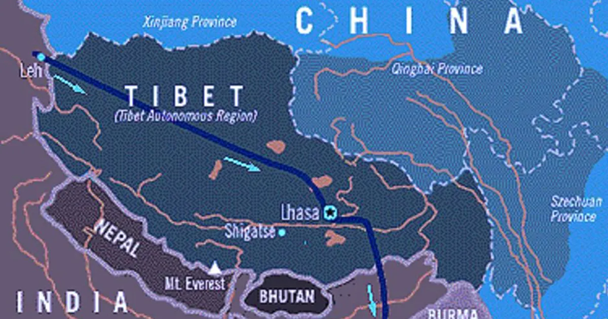
The 1905 Tibet Expedition and the Mapping of Kailash
Among the many expeditions and explorations done in the land of Tibet, the Mount Kailash expedition 1905 was a remarkable one. Initiated by the British Expedition team and supported by Kashmiris, and some Chinese supervision, they started the mapping, with an aim to map the western Tibet, including Lake Mansarovar and Mount Kailash.
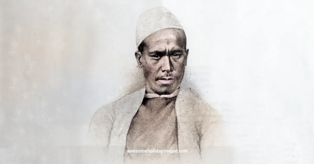
The team had some Indians and Kashmiris who could sketch with measurements. They are the real unsung heroes of the Himalayas, also called Pundits. Along with Nain Singh Rawat, Kishen Singh, Kinthup, and Sarat Chandra Das also played great roles in mapping the Tibetan Himalayas.
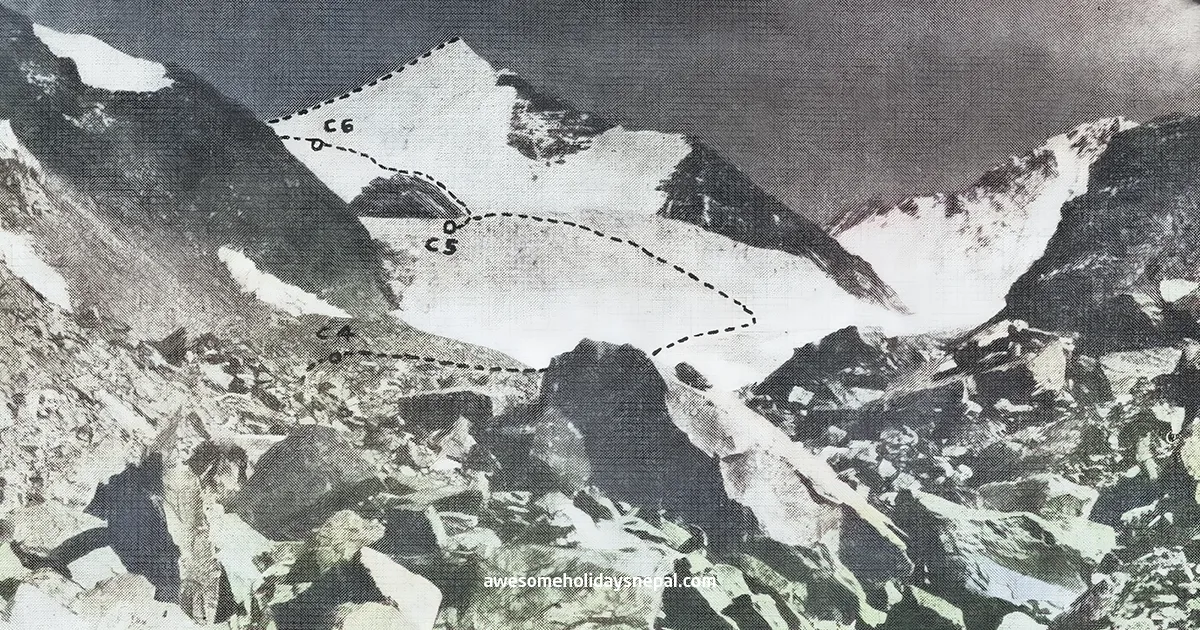
In some historical books, they are praised under the chapter “Sino-Kashmiri geographic survey”. The explorer recorded coordinates, calculated the height of mountains, traced rivers along with some villages. This uncertain draft was forming the base for disputes. But the expedition team suffered some incidents.
With altitude sickness and misunderstanding among the team members, the political tension enlarged. The Tibetans could not trust the team further and used the early draft to claim the region.
The Kailash mapping history from 1905 to the early 20th century, slowly changed the spiritual significance into political. The British Empire was weaker and slowly leaving colonies, but their maps remained, with marks of Kailash inside Tibet.
Administrative Transitions and the Vanishing 1905 Tibet Expedition
Somewhere between forgotten ledgers and crumbling maps, the Himalayan expeditions of the early 1900s got grounded. Those incomplete journeys to document the Himalayas vanished from the official records. The archives are still under the dust nobody wants to open up anymore.
Strangely, the maps once drawn by the 1905 Tibet expedition in notebooks are now just a rumor and mystery among geographers and cartographers. After China annexed Tibet in 1950, the older maps and border sketches began reappearing. China now is using those historical drafts to claim “historical continuity,”.
India, on the other hand, has fewer tales of tangible heritages, mythology, and history of centuries of pilgrimage. India does not have a map of written proofs, but yes, it has only the mystical books and stories of Lord Shiva abiding on Mount Kailash. Mount Kailash is ruled by Lord Shiva, but the entire Tibet is ruled by China. Kailash is now shifted from more bureaucratic of the Tibet Autonomous Region to spiritual.
India vs Tibet on Mount Kailash
Many Indian writers and historians claim that the area encircling Kailash was never part of India. The Mahabharata epic writes Tibet as an ally of the North and calls them the Sri Vishtapam. The people from Sri Vishtapam were in favor of the Pandavas and fought for them. The connection was more cultural and just separated by rivers, not by kingdoms or politics.
When Tibet grew as a hub for Buddhism, the Dalai Lama had a huge sangha, not as a soldier but as a protector of Dharma. The Tibetan plateau was a peaceful world for Buddhists, without soldiers or territorial ambitions. Seeing the gap, the Chinese empire slowly approached Tibet, and everything changed on March 17, 1959. The Dalai Lama flew to India, leaving the heritages of Potala Palace safe in the hands of Chinese Soldiers.
Let’s not dive into this for now. We will write another blog on the issues of Tibet and China.
| Pre-1800s | The religious pilgrimage zone shared by Tibet, Kashmir, and Ladakh | No fixed borders were found, only some rivers marked them |
| 1905 | Chinese-Kashmiri mapping of Kailash under British supervision | The first formal maps were drawn by the 1905 Tibet Expedition |
| 1914 | The Simla Agreement defines the Indo-Tibetan lines roughly | Kailash is marked inside Tibet |
| 1950s | China annexes Tibet | Mount Kailash and the entire Tibet came under the Chinese Government |
| 1962 | Sino-Indian War | Borders reinforced |
| 2000–2020 | Pilgrimage routes reopened under agreements | Indian pilgrims can enter Tibet via a group visa and permits |
Kailash Now: Permits and Visas
Today, in 2025, anyone wishing to pilgrimage to Mount Kailash Mansarovar Yatra must get a group visa and some permits from across the border. With the regular Chinese administration and frequent army checkpoints, Permits, health checks, and registered travel agents from Tibet.
But, the belief in Lord Shiva is marred by the bureaucratic formalities. Thousands of pilgrims from India, Nepal, and beyond continents visit Kailash and complete the Kora.

A Revolutionary Expedition
The inclusion of Mount Kailash in China’s territory by the 1905 Tibet Expedition brought changes in the pilgrimage pattern of Mount Kailash. The early 20th-century Kailash exploration, the Sino-Kashmiri geographic survey, and later Chinese administration had a lot effect on the current status of Mount Kailash Yatra.
Though borders have hardened the pilgrims’ sacred walk, the deep faith and trust in Lord Shiva help to motivate the pilgrims. Geography cannot stop the faith, and still visitors go for the kora around the Axis Mundi, a symbol of universal sacrifice.
Let the man-made divisions in the map encircle Mount Kailash, but Kailash stands eternal above Mansarovar.
FAQs
Expand AllWho mapped Mount Kailash in 1905?
In 1905, some Indians and Kashmiri surveyors worked with the British East India Company, and the British Expedition started mapping Mount Kailash and made the early cartography. during the 1905 Tibet expedition.
What was the Chinese-Kashmiri expedition of 1905?
The Chinese-Kashmiri expedition of 1905 was a geographic survey of Mount Kailash and the surrounding lakes. This team involved Kashmiri and Chinese experts under the British Expedition Team.
Why is the 1905 Kailash expedition forgotten?
The work from the 1905 Kailash expedition lacked proof and political support. The research and drafts were overshadowed by later diplomatic events.
How did early explorers map Mount Kailash?
The first explorers used basic triangulation, line-of-sight sketches, and primitive manual instruments to map Mount Kailash.
What tools were used to map Kailash in 1905?
Simple mapping tools like Sextants, compasses, and sketchbooks were used to map Mount Kailash in 1905.
Did any Kashmiri explorers reach Kailash before 1950?
There were pilgrims and traders, and pilgrims from Kashmir visited long before official mapping began.
What challenges did the 1905 Kailash team face?
The 1905 Chinese–Kashmiri Expedition faced extreme weather, altitude sickness, logistics inadequacy, and resistance by locals to foreigners mapping their land.
Is Mount Kailash open for mapping or survey today?
No, individual or independent surveys are restricted by the Chinese government.
Why is Mount Kailash sacred and hard to map?
The major hurdle for the mapping of Mount Kailash is its religious value. The mountain is significant for believers of all religions.
Are there lost maps of Mount Kailash from the 1900s?
Yes, some historical references say that the maps and cartography from the 1900s are missing and are not made available to the public.
Why was the 1905 Kailash expedition forgotten?
The 1905 Chinese–Kashmiri Kailash Expedition and their works are not exposed as this could provoke the relationship between China and India. This is more political issue than a spiritual.
Related blog posts
Discover a choice of tourist destinations loved by most of our visitors. Whether you're on a jungle safari to spot rare animals or walking through a world heritage site, these well-planned itineraries cover the major highlights of Nepal.


